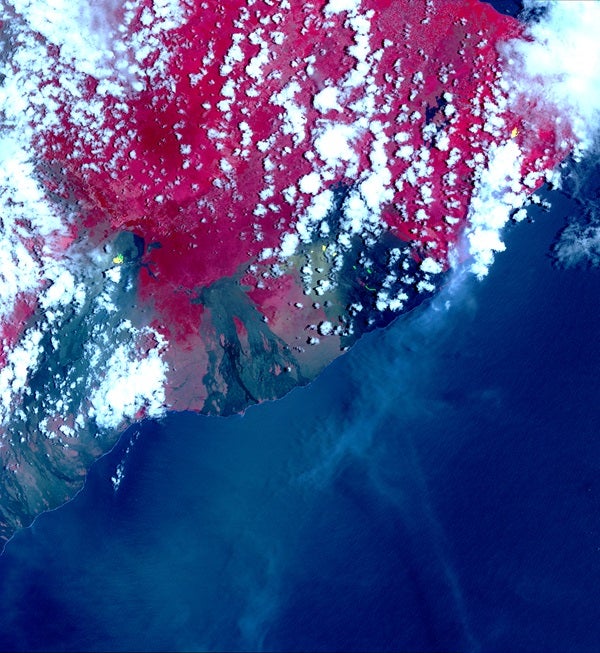
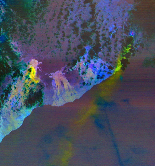
The ASTER images, acquired on May 6, 2008, show different aspects of the eruption. A color composite depicts vegetation in red, and old lava flows in black and gray. Superimposed on the image in yellow are hotspots detected on the thermal infrared bands. The easternmost hot spots show the newly formed fissures and the lava flow spilling to the northwest.
The middle spots are Pu’u O’o crater, and lava flows descending the slopes to the southeast. The westernmost area is the crater and lava lake on Kilauea’s summit. The greenish area southwest of Pu’u O’o is ash deposits from its short eruption on Friday.
The inset [below] shows the massive sulfur dioxide plume is shown in yellow and yellow-green, extracted from ASTER’s multiple thermal bands. A smaller, but thicker, sulfur dioxide gas plume can be seen coming from Kilauea. The prevailing trade winds blow the plumes to the southwest, out over the ocean. The images cover an area of 57.8 by 63 kilometers, and are located at 19.3 degrees North, 155.1 degrees West.
The broad spectral coverage and high spectral resolution of ASTER provides scientists in numerous disciplines with critical information for surface mapping and monitoring of dynamic conditions and temporal change. Example applications are: monitoring glacial advances and retreats; monitoring potentially active volcanoes; identifying crop stress; determining cloud morphology and physical properties; wetlands evaluation; thermal pollution monitoring; coral reef degradation; surface temperature mapping of soils and geology; and measuring surface heat balance.
The U.S. science team is located at NASA’s Jet Propulsion Laboratory, Pasadena, Calif. The Terra mission is part of NASA’s Science Mission Directorate, Washington, D.C.
More information about ASTER is available at http://asterweb.jpl.nasa.gov/.
This press release originally appeared on jpl.nasa.gov.