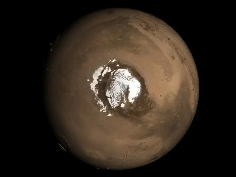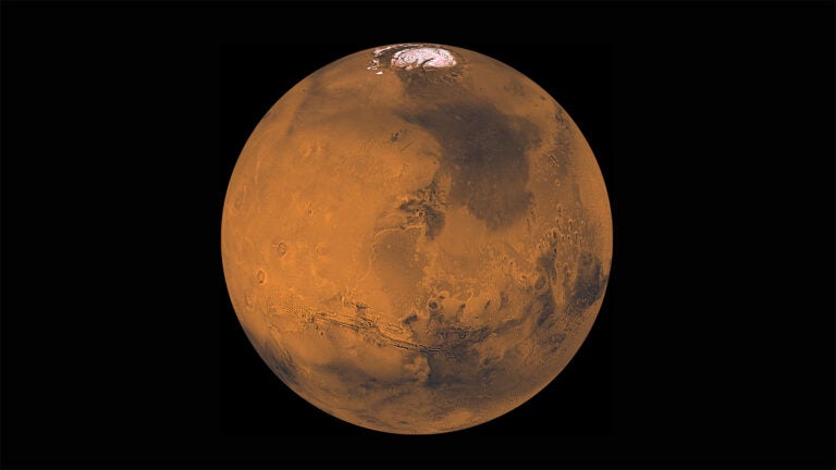
Mars’ surface is speckled with basins thought to have once hosted extensive lakes and rivers. The basins left behind by these long since dried-up bodies of water capture an important record of the geological and environmental conditions endured by the regions, making them prime candidates for exploration and study.
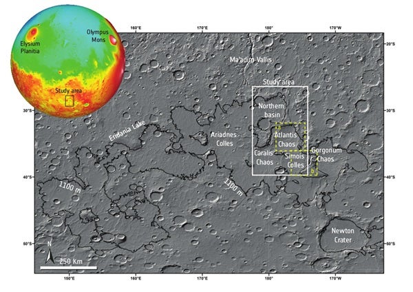
A recent paper describes a study of an area of Mars’ surface known as the Terra Sirenum region, carried out by Solmaz Adeli, Ernst Hauber, Laetitia Le Deit, and Ralf Jaumann, which is thought to have played host to one of the largest lakes on Mars. The body of water, known as the Eridania Lake, once covered an area of over a million square kilometers before dividing into smaller isolated lakes and eventually disappearing altogether along with the rest of the water on the planet.
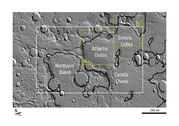
This study focuses on the geological events that occurred before, during, and after the transformation of the gargantuan Eridania Lake into its hypothesized smaller lakes by looking closely at four ancient basins. Each of the four basins — Atlantis Chaos, Simois Colles, Caralis Chaos, and an unnamed basin referred to in the study as the Northern Basin – hosted its own individual lake following the fragmentation of the Eridania Lake.
By combining data from the High Resolution Stereo Camera (HRSC) on ESA’s Mars Express with images from both the High Resolution Imaging Science Experiment (HiRISE) and Context Camera (CTX) on NASA’s Mars Reconnaissance Orbiter (MRO), the team has built up a detailed geological map for the region and accurately modeled the ages of the mapped units. This, complimented by data from MRO’s mineral-finding Compact Reconnaissance Imaging Spectrometer (CRISM), used to characterize the distribution and nature of materials in the area, has enabled the team to interpret the geological history of the region, creating a detailed time frame of its formation and suggesting the most likely mechanisms that led to it.
“Very few geological maps have previously been produced for this area,” said Ralf Jaumann from the DLR and the Free University of Berlin, Germany. “Now, we have investigated the relationships between key geological features in great detail, allowing us to much better constrain our knowledge of past martian climate, aqueous processes, and morphological evolution.”
The oldest geological terrain, dating back to Mars’ Noachian period around 4 billion years ago, is on the highlands that surround the basins. On top of this ancient, cratered surface relentlessly dented by a period of extreme asteroid and meteorite impact, can be seen a younger layer of material which was deposited through the air as dust and ash.
“This younger layer of material sits on the uplands atop the older material, moulded into flat-topped and steep-flanked structures known as Mesas,” said Ernst Hauber from DLR. In the basins themselves, rather than having been sliced into Mesas by wind and water movement, the team found that this material had cracked and eroded to form dramatic knobs of material that extend up to 2,000 feet (600 meters) from the basin floors.
“What this tells us,” continued Hauber, “is that when the material was deposited the Eridania Lake was still very much present, but the water level fell to the point that it was split into a series of smaller lakes early in the Hesperian period, and later in that period the individual basins too began to run dry.”
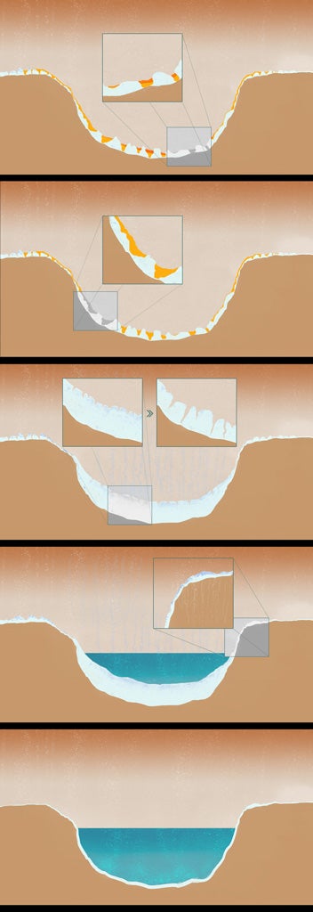
In the Northern Basin, the team also uncovered clues to the final days of the Eridania Lake — and the lakes that followed. Within several shallow depressions in the basin, the phyllosilicate-rich material is partly encrusted with salts that formed as water from rains, snow or ice melt filled the depressions and then evaporated during subsequent dry periods — a process likely to have taken place either at the end of the lakes’ existence or even later when a reoccurrence of liquid water filled the smaller depressions in the area.
The last piece of the puzzle are the two layers of material identified in the study that are thought to have formed early in the Amazonian period, the geological time frame in which Mars currently finds itself. Both were deposited when the basins were completely dry and provide strong evidence that the smaller lakes that followed the Eridania Lake’s demise were wiped away before the Amazonian period began.
“The chloride salts, the phyllosilicates, the knobs of material crafted by the lake’s demise, and a host of other finds all provide new and valuable clues to the history of Mars, its Terra Sirenum region, and the huge Eridania Lake that once resided there,” said Solmaz. “We can now say with some confidence that the lake formed late in the Noachian period and that by early in the Amazonian period neither it nor the smaller lakes that followed remained.”
“This thorough and important map of events on Mars is a testament to what can be achieved through world-wide collaboration,” said Mars Express project scientist Dmitri Titov. “When it comes to the exploration and study of Mars, combining our resources is key, and I am looking forward to the many more studies to come that will take advantage of the multi-national spacecraft in orbit and on the surface of Mars.”