Find out for yourself below. Each image shows a formation on Earth, Mars, or Titan, but it’s your job to guess which. Some of the photos have been converted to grayscale to make things a little more exciting. How well do you know planet Earth? (Find the answers and and more information about each photo below the gallery.)
Answers
#1: It’s Titan! This image taken by Cassini’s radar instrument shows bodies of liquid near Titan’s north pole. It offers strong evidence that larger bodies seen in infrared images are, in fact, seas of most likely liquid methane and ethane.
#2: It’s Earth! The Rub’ al Khali is one of the largest sand deserts in the world, encompassing most of the southern third of the Arabian Peninsula. It includes parts of Oman, the United Arab Emirates and Yemen. The desert covers an area larger than France.
#3: It’s Earth! This striking photograph from the International Space Station features two examples of craters. Toward the right, the broad shield volcano of Emi Koussi is marked by three overlapping calderas that were formed by eruptions. The circular Aorounga Impact Crater lies approximately 68 miles (110 kilometers) to the southeast of Emi Koussi and is thought to record a meteor impact from approximately 345 to 370 million years ago. The linear features (image lower left) that arc around Emi Koussi and overprint Aorounga and the surrounding bedrock are known as yardangs — rock ridges formed by wind erosion.
#4: It’s Mars! Dunes of sand-sized materials have been trapped on the floors of many martian craters. This is one example, from a crater in Noachis Terra, west of the giant Hellas impact basin. The dunes here are linear, thought to be due to shifting wind directions. In places, each dune is remarkably similar to adjacent dunes. Large angular boulders litter the floor between dunes.
#5: It’s Titan! The image shows long, dark ridges on Titan’s surface. These are interpreted to be longitudinal dunes. Dunes are mostly an equatorial phenomenon on Titan, and the material forming them may be solid organic particles or ice coated with organic material. Spaced up to 2 miles (3km) apart, these dunes curve around bright features that may be high-standing topographic obstacles, in conformity with the wind patterns.
#6: It’s Earth! The Shoemaker (formerly Teague) Impact Structure — located in Western Australia to the southeast of the Carnarvon Range — presents an other-worldly appearance in this astronaut photograph. The Shoemaker impact site is approximately 19 miles (30km) in diameter and is clearly defined by concentric ring structures formed in sedimentary rocks. The rocks were deformed by the impact event approximately 1.63 billion years ago.
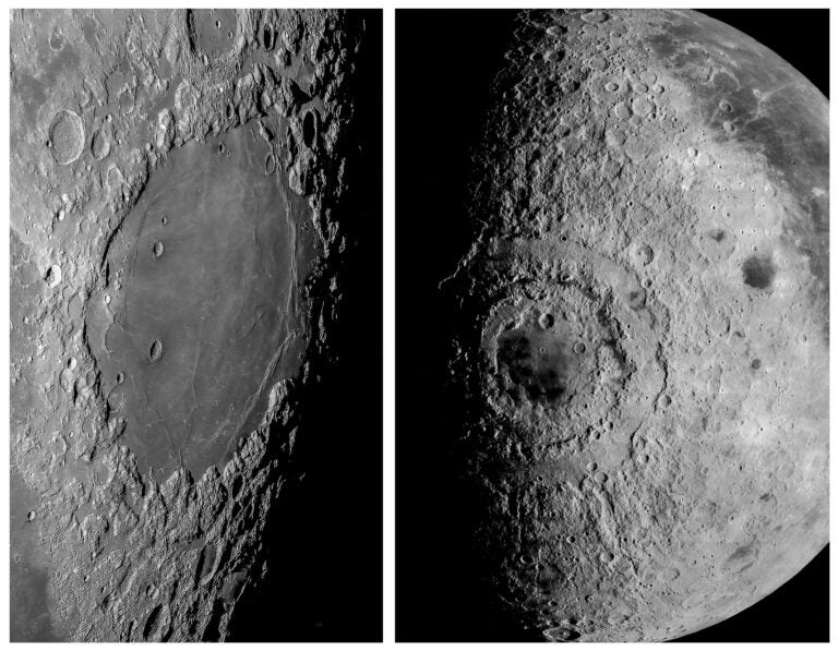
#7: It’s Titan! This image, created by combining two different types of radar images from NASA’s Cassini spacecraft, reveals details of Titan’s crater Menrva (at left) and its surroundings, including a channel system to Menrva’s right.
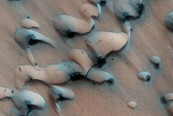
#8: It’s Mars! This image shows dunes near the north pole of Mars. The north pole is surrounded by a vast “sea” of basaltic sand dunes, and the dunes imaged here are similar to barchan dunes that are commonly found in desert regions on Earth.
#9: It’s Titan! This image of Titan’s surface is a flattened projection of the view from the European Space Agency’s Huygens probe, depicting four different altitudes. Revealed is a world that looks a lot like Earth, with surface features like riverbeds, vast deserts covered in dunes, and even lakes filled not with water, but liquid hydrocarbons.
#10: It’s Earth! This image of Namib Desert in southwest Africa shows where ocean and desert meet. Mists made when warm air and the cold Benguela Current meet is peculiar to the area, but rainfall doesn’t reach the inner desert area because the mists that formed along narrow coastal zone scatter away instantly.

