Planetary scientist Bruce Banerdt, the mission’s principal investigator, has been studying the formation and evolution of Mars and other planets at Caltech’s Jet Propulsion Laboratory (JPL) since 1983. For decades, he and scores of other planetary geophysicists from around the world have been thinking about ways to learn whether Mars is dead or alive.

Bringing the universe to your door. We’re excited to announce Astronomy magazine’s new Space and Beyond subscription box – a quarterly adventure, curated with an astronomy-themed collection in every box. Learn More >>.
They knew that seismology — the study of earthquakes and related phenomena — was the key to understanding Earth’s interior. But to do similar research on Mars meant that they’d have to figure out how to build and deploy seismometers and other geophysical sensors that could handle the stresses of a launch from Earth and the harsh environment of Mars’ surface. And they knew that it wouldn’t be possible to deploy a global network of thousands of seismometers like we have on our planet. At best, they could contemplate setting up a small network of at least a few seismometers and other instruments, like the Apollo astronauts had done at six landing sites on the Moon, using spacecraft similar to those that had already successfully landed on Mars. At worst, they could deploy only one.
And indeed, one it would have to be. The costs, complexity, and risks of attempting multiple landings on Mars simply didn’t fit within the constraints of NASA’s “faster, better, cheaper” Discovery program line, and no larger-class missions to study martian geophysics were scheduled for the foreseeable future. So, Banerdt began lining up a team to make the best possible pitch to NASA for a mission to study Mars’ interior.
Is Mars alive?
Prior to InSight, planetary scientists had a rudimentary understanding of what the interior of Mars was probably like, and some crude hypotheses about its level of activity. Based on general similarities among our solar system’s terrestrial planets, and on basic physical, compositional, geologic, and other information about Mars provided by previous missions, researchers also deduced that Mars was differentiated — with an interior segregated into a core, mantle, and crust like Earth’s.
NASA’s Mars Global Surveyor orbital mission in the mid-1990s provided a key piece of information supporting this hypothesis. The spacecraft’s magnetometer measured strong magnetic fields in the rocks on certain parts of the planet’s surface. Scientists presume these signatures are remnants of what was once a global magnetic field, perhaps similar in some ways to Earth’s. Our planet’s magnetic field arises in the core. This partially melted, spinning ball of highly conductive iron creates a strong magnetic field that extends from the core well out into space. The field helps shield the surface from harmful radiation and allowed life to emerge and thrive here. Did Mars once have a partially molten core that gave rise to a similarly beneficial global magnetic field?
But is that core still at least partially molten? Does Mars have enormous quantities of internal heat — high heat flow, in geophysical terms — like Earth, and does that heat drive contemporary geologic processes? Mars has no global magnetic field today, which is one argument that the core has solidified and the interior is no longer active.
Other arguments against high heat flow include the absence of any proof for recently active volcanoes or hotspots, as well as no convincing evidence for past or present plate tectonics. Earth’s crust is divided into a dozen or so large tectonic plates. These plates move relative to one another, causing most of our planet’s earthquakes and volcanoes, and play a role in helping our planet release its internal heat. But from orbit, Mars appears to be a one-plate planet with no obvious internal geologic activity. Could surface observations verify this supposition?
The InSight mission team worked frantically for four years to design, build, and test the lander and its instruments in time to meet the planned 2016 launch. The task proved challenging because a number of technical and management problems cropped up along the way. The most serious of these was a small leak in the housing for the seismometer, which needs to operate in a vacuum to achieve its required sensitivity, discovered several months before the scheduled launch.
The instrument, built by a European consortium led by the French Space Agency (CNES), could not be repaired in time and the launch was delayed for two years. NASA estimated the cost of this delay at around $150 million, canceling out the hoped-for savings from relying on a heavily international science payload.
The delay also had ramifications within NASA. The space agency realized that highly technical international collaborations can be exceedingly difficult to manage and decided to tighten the rules on how much outside countries could contribute to instruments on future missions. The new limit is now one-third the total cost of all instruments.
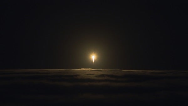
The delay did give JPL, Lockheed, and their international partners time to diagnose and repair the problems, and to test the full system in a giant, Mars-simulating vacuum chamber at Lockheed’s facility in Colorado. Technicians then packaged the spacecraft into its protective cruise-stage aeroshell and heat shield and shipped it to Vandenberg Air Force Base in California, where it would become the first interplanetary mission launched from the U.S. West Coast. NASA chose Vandenberg over the usual Cape Canaveral Air Force Base launch facility in Florida because it could better handle the spacecraft’s large mass and gave more flexibility in timing the launch. In the wee hours of May 5, 2018, an Atlas V rocket lit up the skies north of Los Angeles and set InSight on its way to Mars.
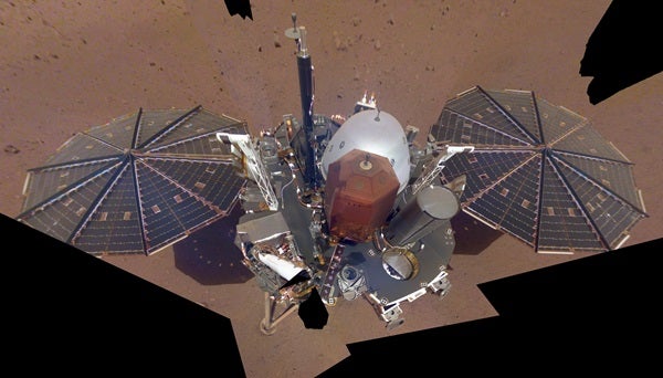
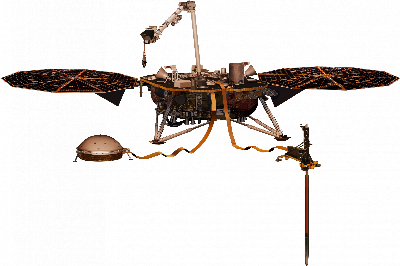
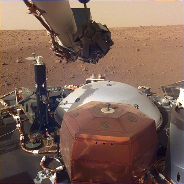
The InSight lander carries two cameras — one mounted below the deck and the other on the robotic arm — three main sets of geophysical experiments, and one set of meteorological instruments. The geophysical experiments include the CNES-led seismometer package called the Seismic Experiment for Interior Structure (SEIS). The science team designed it to detect potential marsquakes with up to 300 times the sensitivity of typical terrestrial seismometers, and to measure the strength of the magnetic field at Mars’ surface.
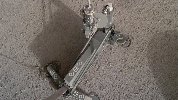
The German Aerospace Center built the Heat Flow and Physical Properties Package (HP3), which will measure the planet’s heat flow and conductivity by hammering a small probe nicknamed “the mole” as deep as 16 feet (5 meters) into the subsurface. The JPL-led radio transmitter experiment, called the Rotation and Interior Structure Experiment (RISE), will improve upon the experiments on previous landers that helped deduce the nature of the planet’s interior, including the size of the core. The Temperature and Winds for InSight (TWINS) meteorology package consists of several temperature, pressure, wind speed, and wind direction sensors placed at various heights on the lander.
In addition, the lander carries a passive retroreflector that will allow future Mars orbiters to shoot laser beams at the device and accurately track their range to the surface. Apollo astronauts left similar devices on the Moon that let scientists precisely monitor the distance between Earth and its satellite. Finally, the probe carries two tiny silicon wafer chips upon which NASA microscopically etched the names of more than 2.4 million people who signed up to have their names sent to Mars.
In addition, the heat shield-parachute-retrorocket landing system, inherited from the Phoenix lander, did not have the sophisticated obstacle-avoidance systems that have allowed other missions to target specific small areas. In fact, the mission’s landing ellipse — the region of uncertainty where the spacecraft was most likely to set down — stretched a robust 81 by 17 miles (130 by 27 kilometers). Compare that with the Curiosity rover’s landing ellipse, which spanned just 12 by 4 miles (20 by 7 km).
Thus, the InSight team wanted the spacecraft to land in a big, flat, rock-free, sand-free, low-dust parking lot. Indeed, it was almost the exact opposite of what most planetary geologists seek — exotic minerals, sedimentary layers, hills, valleys, water-related landforms — when they want to land on Mars. Luckily for the InSight team, Mars has an abundance of flat, relatively boring places. One particular site — in Elysium Planitia near 4.5° north latitude and 135.0° east longitude — also satisfied the mission’s additional requirements: a low elevation for the parachute to work well and an equatorial region so the mission could operate under solar power.
After a speedy and relatively uneventful six-and-a-half-month cruise to Mars, InSight team members and millions following online experienced their own “seven minutes of terror” as the spacecraft autonomously executed its carefully choreographed set of entry, descent, and landing activities November 26, 2018.
Unpacking for a long stay
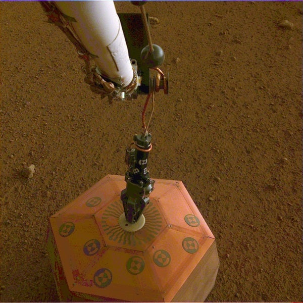
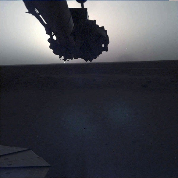
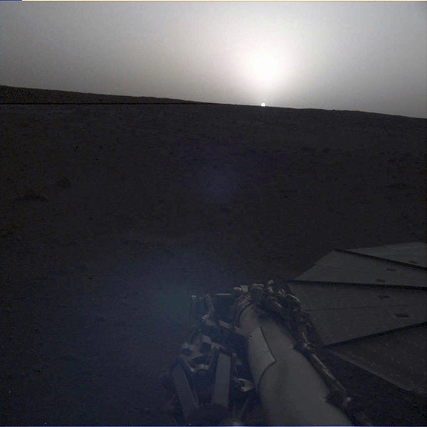
Although the cameras started taking pictures and TWINS began collecting Mars weather data soon after landing, it took more than three months to truly complete the landing process. That’s because many of InSight’s key geophysics instruments were packed on the lander’s deck during the journey to Mars. To work properly, the Instrument Deployment Arm (IDA) had to carefully unpack and then set them in contact with the rocky surface.
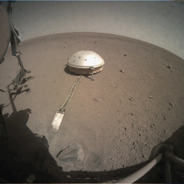
The InSight team deployed SEIS first, on December 18, or sol 22. (Mars scientists typically express time on the planet’s surface in sols. One sol is the length of a martian day, and equals 24 hours 39 minutes 35 seconds.) It would take until sol 66 (early February 2019) to complete the adjustments of the seismometer’s tether back to the rover and to cover the instrument with its protective Wind and Thermal Shield (WTS) designed to lower background noise that the sensitive instrument would otherwise pick up.
HP3 was deployed to the surface on sol 76 (February 12), and it began hammering the mole into the subsurface on sol 92 (February 28). After a long wait, the mission team could finally begin to collect all the different kinds of measurements it had set out to make.
In a sense, then, the InSight mission has only just started. The SEIS team detected its first probable marsquake on sol 128 (April 6), but as of early July, it has yet to pick up a second. The quake had a magnitude between 2.0 and 2.5 — a quiver, really, that a human would not have felt if it had occurred on Earth. Despite the apparent calm on Mars, the seismometers are operating beautifully, detecting ground motions on the scale of 25 picometers — just 20 percent the diameter of a hydrogen atom! SEIS’s high sensitivity has also recorded the effect of what team members presume to be numerous dust devils as well as other kinds of low-frequency atmospheric turbulence, known as infrasound, passing over the seismometer.
Meanwhile, TWINS has been generating outstanding daily Mars weather reports. It discovered a small dust storm starting around sol 42 and has detected dozens of smaller atmospheric disturbances passing over the lander every sol.
The instrument’s pressure sensors have observed many of the same infrasound-producing small-scale atmospheric vortices that the seismometer has detected. Most of these atmospheric vortices have not produced visible dust devils in camera images, however, indicating that a whole new class of atmospheric disturbances — “dustless devils” — apparently exists, and InSight’s instruments will be able to study them for the first time.
Scientists have even taken simultaneous weather measurements and images when Mars’ larger moon, Phobos, eclipses the Sun. The moon’s shadow produces tiny drops in temperature and light levels during these events, which last less than 30 seconds.
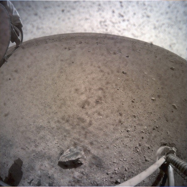
And, of course, the lander and IDA cameras continue their imaging to monitor the instruments as well as to understand the geologic context of the Elysium site. The rocky rims of several small, distant impact craters dot the landscape, and dusty material fills smaller nearby craters that scientists have dubbed hollows. The team got the pretty flat and rock-free site they were hoping for — rocks cover less than 4 percent of the surface.
Even though InSight carries no mineralogy or geochemistry instruments, the images alone are consistent with a bedrock surface of volcanic origin fractured and pulverized to depths of many tens to hundreds of meters by eons of countless impacts. This material is probably basaltic, like most of Mars and the typical lava flows seen in Hawaii and Iceland. Geologically, InSight’s landing site in Elysium Planitia turns out to have a lot in common not only with the Spirit rover’s landing site in Gusev Crater but also with the Phoenix mission’s landing site in the high-latitude northern plains.
A legacy in the making
Although InSight’s full payload became operational only a few months ago, the mission is already making important meteorological discoveries about the current martian climate. And with the successful deployments of all the main instruments except for the mole, the stage is now set for the mission to make historical geophysical discoveries as well. Now, it’s time for Mars to cooperate.
With the first marsquake now in the books, how many more will be found? And will these turn out to be the results of nearby impacts, some deep, internal churning of a still-active mantle or core, or both? Is Mars as dead as the Moon, or does it still experience some internal activity? Over the coming years, scientists expect to record many seismic events. What will they reveal about the planet’s internal structure, and what can scientists glean from this about the timescale over which the planet’s once-abundant volcanism and strong magnetic field waned?
And ultimately, what other new insights will come from InSight? Stay tuned — the latest round of excitement and discovery on the Red Planet has only just begun.

