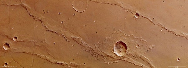
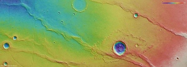
On April 17, the orbiter pointed its high-resolution stereo camera at the Melas Dorsa region of Mars. This area sits in the volcanic highlands of Mars between Sinai and Thaumasia Plana, 160 miles (250 kilometers) south of Melas Chasma. Melas Chasma itself is part of the Valles Marineris rift system.
The image captures wrinkle ridges, some unusual intersecting faults, and an elliptical crater surrounded by ejecta in the shape of a butterfly and with a strange “fluid-like” appearance.
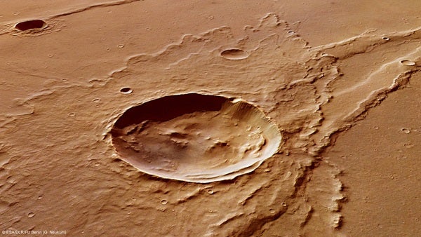
Scientists have suggested that a fluidized ejecta pattern indicates the presence of subsurface ice that melted during the impact. Subsequent impacts have created a number of smaller craters in the ejecta blanket.
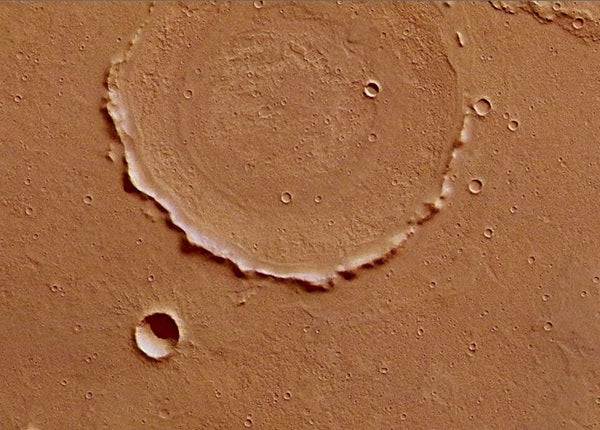
This makes any detailed study of it almost impossible. However, its center shows concentric deposits that could provide insights into the composition of the volcanic material that buried it.
To the left, the ridges are bisected by crustal displacement faults. These have cut into the ridges and the surrounding surface at some later epoch. This highlights the different tectonic phases responsible for the formation of this region.