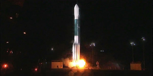
JPSS-1, which will share an orbit with the joint National Oceanic and Atmospheric Administration (NOAA)/NASA Suomi National Polar-orbiting Partnership satellite, has the potential to increase reporting accuracy of upcoming atmospheric events. Its instruments will be able to observe and collect weather pattern data, such as sea-ice cover, fire detection, volcanic ash, and atmospheric temperature. The satellite is also designed to capture post-storm imagery, including storm damage extent and power loss, which could prove beneficial for storm damage recovery efforts.
“Launching JPSS-1 underscores NOAA’s commitment to putting the best possible satellites into orbit, giving our forecasters — and the public — greater confidence in weather forecasts up to seven days in advance, including the potential for severe, or impactful weather,” said Stephen Volz, director of NOAA’s Satellite and Information Service, in a press release.
The JSPP-1 boasts five advanced instruments that have undergone substantial upgrades from NOAA’s past satellites. The bus (or infrastructure) of the JSPP-1 satellite and its Ozone Mapping and Profiler Suite instrument were conceptualized and constructed by Ball Aerospace, who also provided launch support and satellite testing. They are also credited with implementing five instruments featured on the JSPP-1: the Visible Infrared Imaging Radiometer Suite and the Common Ground System built by Raytheon Corporation, the Advanced Technology Microwave Sounder and the Clouds and the Earth’s Radiant Energy System instrument built by Northrop Grumman Aerospace Systems, and the Cross-track Infrared Sounder built by Harris Corporation.
Made possible through a partnership between NASA and NOAA, the JPSS program could be a game changer for those collecting and reporting weather patterns, and for those anticipating the impact.
More information about the JPSS program can be found here.

