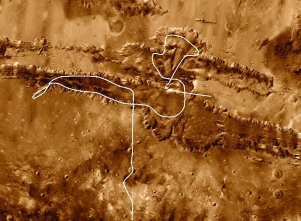
Now, you can explore Valles Marineris up close in a video produced by NASA’s Jet Propulsion Laboratory (JPL) and Arizona State University. The video takes you on a simulated plane ride over and through the rugged valley. To make the video, imaging wizards combined a high-resolution mosaic of Valles Marineris taken at infrared wavelengths by NASA’s Mars Odyssey orbiter with more than 50 million altitude measurements recorded by NASA’s Mars Global Surveyor spacecraft.
The visualization software and hardware are off-the-shelf items. The software used to merge the Odyssey mosaic and the Global Surveyor topography into a landscape — and to create the flight animation — is LightWave 3D, a commercially available standard in the digital video and games business. A plug-in, InfiniMap Pro, allowed LightWave to handle the large data sets. With a total price of about $1,200, LightWave 3D plus InfiniMap Pro hardly cost pocket change, but neither is this something that takes a research grant to buy — or a rocket scientist to run.
And the hardware? Any up-to-date Mac or PC with ample RAM and video capability can make animations such as this.
“A lot of aerospace managers still think it takes big equipment costing millions of dollars to do things like this,” says lead animator and project head Zareh Gorjian of JPL. “In fact, the exact opposite is true. Stuff like this cannot be done on supercomputers because the software doesn’t run on them — only on desktops and laptops.”
So sit back, relax, and take the ride of a lifetime by clicking on the link below. Mariner Valley awaits your arrival.

