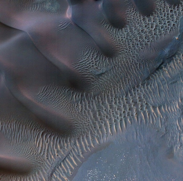
The scene shows dunes and sand ripples of various shapes and sizes inside an impact crater in the Noachis Terra region of southern Mars. Patterns of dune erosion and deposition provide insight into the sedimentary history of the area.
The MRO has been examining Mars with six science instruments since 2006. Now in an extended mission, the orbiter continues to provide insights about the planet’s ancient environments and about how processes such as wind, meteorite impacts, and seasonal frosts are continuing to affect the martian surface today. This mission has returned more data about Mars than all other orbital and surface missions combined.
More than 20,600 images taken by HiRISE are available for viewing on the instrument team’s website: http://hirise.lpl.arizona.edu. Each observation by this telescopic camera covers several square miles and can reveal features as small as a desk.

