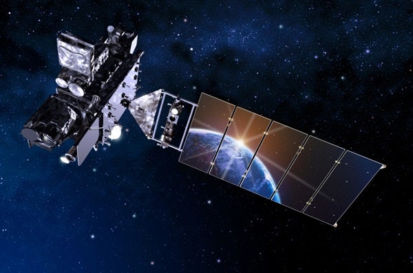
The National Optical Astronomy Observatory (NAOAO) is ready to launch the Geostationary Operational Environmental Satellite-R Series (GOES-R) on an Atlas V 541 rocket November 19 at 5:45 P.M. EST.
This satellite is the most advanced geostationary weather satellite to date, and will produce images with a spatial resolution of 0.5 to 2mi (km), more vivid and faster than most current GOES satellites.
With three times more channels for data and four times the resolution, GOES-R will advanced imaging, increased spatial resolution, improved monitoring of solar activity, and will return the data five times faster than before.
IT will also provide more accurate forecasts and real-time mapping of lightning.
GOES-R uses a new instrument called the Advanced Baseline Imager (ABI) that uses several different applications related to weather, oceans, land, climate and hazards. The ABI will be useful in obtaining data and imagery about weather over the entire Western Hemisphere in real time.
Once GOES-R is launched, it will be in geosynchronous orbit, which is an orbit that keeps the satellite over the exact same area by matching the orbital period to Earth’s rotation.
It will launch tomorrow from the Space Launch Complex 41 at Cape Canaveral Air Force Station, Florida and can be watched live on NASA TV. Coverage will end once GOES-R detaches from the Centaur upper stage and the solar arrays are deployed, which should be about 3.5 hours after it launches.


