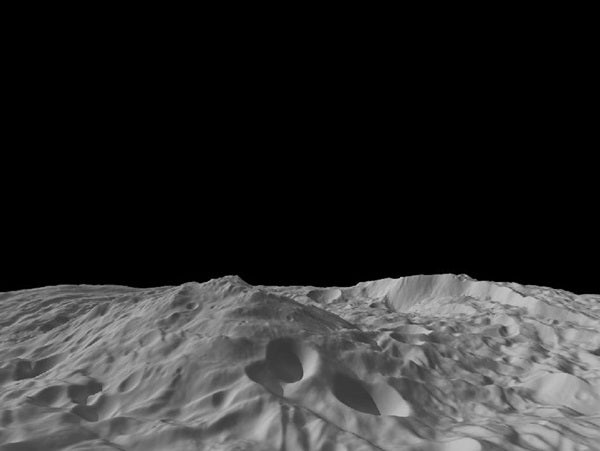
The peak of Vesta’s south pole mountain, seen in the center of the image, rises about 13 miles (22 kilometers) above the average height of the surrounding terrain. Another impressive structure is a large scarp, a cliff with a steep slope, on the right side of this image. The scarp bounds part of the south polar depression, and the Dawn team’s scientists believe features around its base are probably the result of landslides.
The image was created from a shape model of Vesta and shows an oblique perspective view of the topography of the south polar region. The image resolution is about 1,000 feet (300 meters) per pixel, and the vertical scale is 1.5 times that of the horizontal scale.


